Navigácia: Dovolenky podľa krajín: > Slovensko >
Slovensko
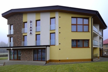
Hotel: Depandance Diana (Kúpele Lúčky) - iné voľné termínyTermín: 12.10.2024 - 18.10.2024 (7 dní)
Strava: Plná penzia
Orientačná cena: 508 EUR
Doprava: Vlastná
Typ pobytu: Pobytové | Kúpelné
Typ zájazdu: Katalóg
Tip: |
Overiť dostupnosť a cenu | Naspäť

Nasledujú doplňujúce informácie k téme Súbor:Rzeczpospolita_Rozbiory_3.png:

Veľkosť tohto náhľadu: 729 × 600 pixelov. Iné rozlíšenia: 292 × 240 pixelov | 584 × 480 pixelov | 934 × 768 pixelov | 1 245 × 1 024 pixelov | 1 906 × 1 568 pixelov .
Pôvodný súbor (1 906 × 1 568 pixelov, veľkosť súboru: 325 KB, MIME typ: image/png)
Zhrnutie
| Popis |
Беларуская (тарашкевіца):
English: Partitions of the Polish-Lithuanian Commonwealth in 1772, 1793 and 1795.
Падзелы Рэчы Паспалітай (1772, 1793 і 1795).Deutsch: Die Teilungen Polen-Litauens 1772, 1793 und 1795. |
| Dátum | |
| Zdroj |
Vlastné dielo Corresponding maps available online: http://wlaczpolske.pl/pliczki/2030 Map. Archived from the original on 18 July 2016. |
| Autor | Halibutt |
| Povolenie (Využívanie tohto súboru) |
GFDL, see below |

|
Tento obrázek (skupina historical map) by měl být vytvořen pomocí vektorové grafiky jako SVG soubor. To má několik výhod; podrobnosti najdete na stránce Commons:Media for cleanup. Je-li SVG verze tohoto obrázku již k dispozici, prosím nahrajte ji. Po nahrání nahraďte tuto šablonu šablonou {{Vector version available|jméno nového obrázku.svg}}.
|
Licencovanie
Since the legal status of the above comment has been questioned, I hereby grant anyone the right to treat it as either a standard copyright notice, invariant section, legal statement, legal advice, friendly suggestion or a mere comment, depending on his or hers own choice. |
|

derivative works
Derivative works of this file: Partitions of Poland.png
| Annotations | This image is annotated: View the annotations at Commons |
História súboru
Po kliknutí na dátum/čas uvidíte ako súbor vyzeral vtedy.
| Dátum/Čas | Náhľad | Rozmery | Používateľ | Komentár | |
|---|---|---|---|---|---|
| aktuálna | 10:24, 23. marec 2020 | | 1 906 × 1 568 (325 KB) | Claude Zygiel | Some names and cosmetic |
| 16:08, 18. júl 2016 |  | 1 906 × 1 568 (218 KB) | Poeticbent | per en:Talk:Partitions of Poland - accessibility for people with color vision impairment, dead space cropped | |
| 10:30, 8. december 2009 |  | 2 000 × 1 568 (184 KB) | Tryphon | Removed watermark. | |
| 21:06, 16. február 2006 |  | 2 000 × 1 568 (241 KB) | Tomekpe | Corrected mistakes: * Silesia at the time belonged to Prussia, whereas the map shows it belonging to Austria. | |
| 21:52, 25. december 2005 |  | 2 000 × 1 568 (241 KB) | Tomekpe | Halibutt's graphic with changing polish-russian border (Krasny Horodok area). | |
| 13:41, 10. január 2005 |  | 2 000 × 1 568 (335 KB) | Halibutt | Partitions of the Polish-Lithuanian Commonwealth<br>{{User:Halibutt/maps}}<br>{{User:Halibutt/GFDL}}<br>Category:Maps of Poland<br>Category:Historical maps |
Použitie súboru
Na tento súbor odkazuje nasledujúca stránka:
Globálne využitie súborov
Nasledovné ďalšie wiki používajú tento súbor:
- Použitie na an.wikipedia.org
- Použitie na ar.wikipedia.org
- Použitie na arz.wikipedia.org
- Použitie na azb.wikipedia.org
- Použitie na az.wikipedia.org
- Použitie na ba.wikipedia.org
- Použitie na be-tarask.wikipedia.org
- Použitie na be.wikipedia.org
- Použitie na bg.wikipedia.org
- Použitie na ca.wikipedia.org
- Použitie na cs.wikipedia.org
- Použitie na da.wikipedia.org
- Použitie na de.wikipedia.org
- Použitie na de.wikibooks.org
- Použitie na el.wikipedia.org
- Použitie na en.wikipedia.org
- Poland
- Partitions of Poland
- Catherine the Great
- Talk:Partitions of Poland
- Kingdom of Prussia
- Polish–Lithuanian Commonwealth
- Stanisław August Poniatowski
- Polish–Soviet War
- Western Krai
- Anti-Polish sentiment
- Causes of the Polish–Soviet War
- Wikipedia:Administrators' noticeboard/IncidentArchive23
- Territorial evolution of Russia
- Talk:Hanka Bielicka
Zobraziť ďalšie globálne použitie tohto súboru.
Metadáta
Text je dostupný za podmienok Creative Commons Attribution/Share-Alike License 3.0 Unported; prípadne za ďalších podmienok. Podrobnejšie informácie nájdete na stránke Podmienky použitia.