Grécko
Lokalita: Kréta
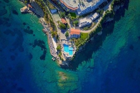
Hotel: Peninsula Resort & Spa - iné voľné termíny Hviezdičky:

Hodnotenie: 46% / 4 hlasov
Termín: 20.08.2024 - 24.08.2024 (5 dní)
Strava: All Inclusive
Orientačná cena: 1062 EUR
Doprava: Letecky Odlet: Praha
Typ pobytu: Pobytové | Pri mori
Typ zájazdu: Katalóg
Tip: |
Overiť dostupnosť a cenu | Naspäť
Silvester
Silvester v hoteli Peninsula Resort & SpaSilvester v oblasti KrétaSilvester v krajine Grécko
Všetky pobyty v hoteli Peninsula Resort & SpaVšetky zľavy v hoteli Peninsula Resort & SpaZľavy v oblasti KrétaZľavy v krajine Grécko

Nasledujú doplňujúce informácie k téme Súbor:Crete_topo.png:

Veľkosť tohto náhľadu: 800 × 369 pixelov. Iné rozlíšenia: 320 × 148 pixelov | 640 × 295 pixelov | 1 500 × 692 pixelov .
Pôvodný súbor (1 500 × 692 pixelov, veľkosť súboru: 811 KB, MIME typ: image/png)
| Popis | Description: Topography of Crete, created with GMT 4.1.3 | ||||||||||
| Dátum | |||||||||||
| Zdroj |
At least one of the following Public Domain data sources |
||||||||||
| Autor | Zamonin | ||||||||||
| Povolenie (Využívanie tohto súboru) |
|

História súboru
Po kliknutí na dátum/čas uvidíte ako súbor vyzeral vtedy.
| Dátum/Čas | Náhľad | Rozmery | Používateľ | Komentár | |
|---|---|---|---|---|---|
| aktuálna | 13:19, 20. november 2012 | | 1 500 × 692 (811 KB) | Zamonin | new labels |
| 07:27, 8. máj 2009 |  | 1 500 × 738 (782 KB) | Zamonin | added cities, mountains; used etopo1 instead of etopo2 | |
| 07:41, 5. máj 2009 |  | 1 500 × 756 (769 KB) | Zamonin | added cities with more than 10.000 inhabitants used etopo1 instead of etopo2 | |
| 10:18, 12. júl 2006 |  | 1 500 × 729 (502 KB) | Zamonin | == Description, Source == * Description: Topography of Ctrete, created with http://gmt.soest.hawaii.edu/ GMT 4.1.3 * Source: At least one of the following Public Domain data sources ** http://http://dss.ucar.edu/datasets/ds759.3/ ETOPO2 (Resolution 2 |
Použitie súboru
Na tento súbor odkazuje nasledujúca stránka:
Globálne využitie súborov
Nasledovné ďalšie wiki používajú tento súbor:
- Použitie na cs.wikipedia.org
- Použitie na de.wikipedia.org
- Použitie na en.wiktionary.org
- Použitie na es.wikipedia.org
- Použitie na he.wikipedia.org
- Použitie na hy.wikipedia.org
- Použitie na it.wikipedia.org
- Použitie na nds-nl.wikipedia.org
- Použitie na nds.wikipedia.org
- Použitie na nl.wikipedia.org
- Použitie na nn.wikipedia.org
- Použitie na no.wikipedia.org
- Použitie na pl.wiktionary.org
- Použitie na ru.wikipedia.org
- Použitie na sv.wikipedia.org
- Použitie na szl.wikipedia.org
- Použitie na uk.wikipedia.org
/%D0%90%D1%80%D1%85%D1%96%D0%B2_2)
Metadáta
Text je dostupný za podmienok Creative Commons Attribution/Share-Alike License 3.0 Unported; prípadne za ďalších podmienok. Podrobnejšie informácie nájdete na stránke Podmienky použitia.